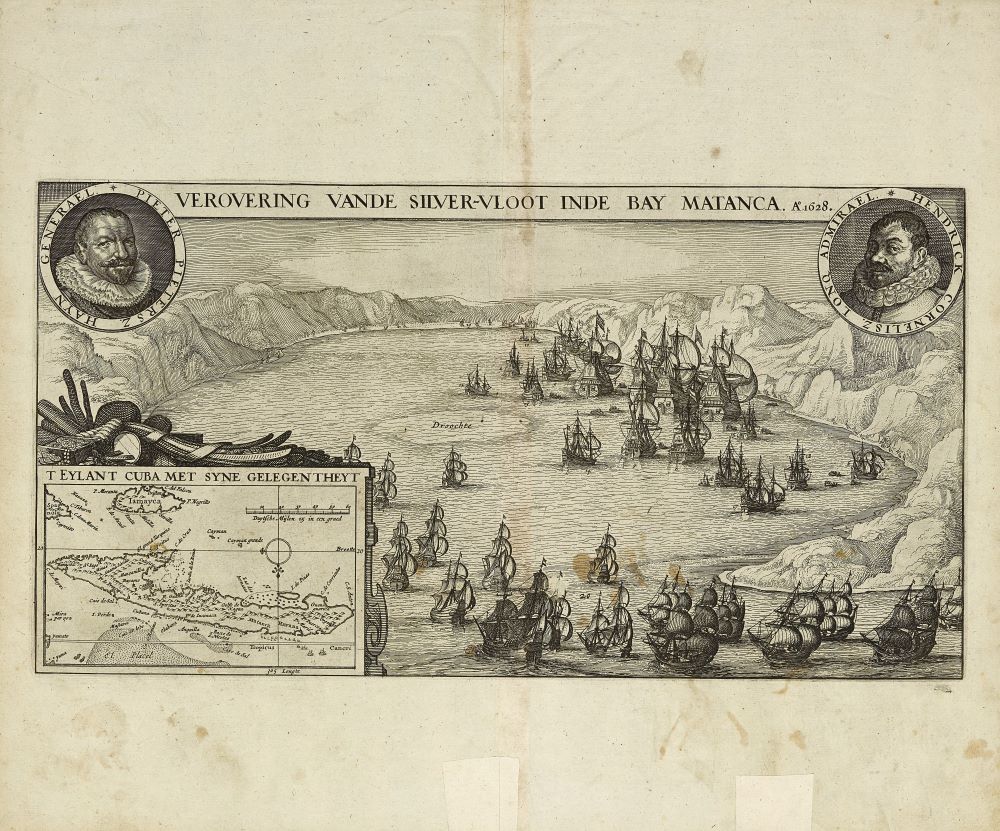
Printed in Holland in 1628, this map shows a “birds-eye-view” of the port of the Bay of Matanzas made by cartographers who likely never visited either Cuba or the province of Matanzas themselves. Hence, they erroneously depicted the Bay of Matanzas (whose name commemorates the Spanish massacre of native people on the site) as a volcanic mountainous landscape. Spanish galleons are front and center, presumably loaded with silver gathered by local indigenous people from Spain’s two colonial mines in Zacatecas, Mexico and Potosí (in contemporary Bolivia), through the mita, a form of colonial forced labor. Probably created in order to encourage Dutch investment through imperial lines of shipping or future Dutch settlement, this map includes a scale bar of Dutch miles at the bottom so as to explain the size and appeal of Matanzas Bay to viewers. It is a historic jewel in the UF Smathers Library Map Collection!
Special thanks this curation to Dean of Libraries Judith Russell and Librarians Carol McAuliffe, Adrienne Johnson, Paul Kirk and Jennifer Farrington.
