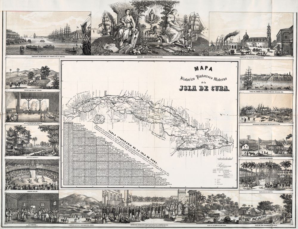
Probably made in the late 1840s, this detailed map of Cuba features evidence of its “modern picturesque” advancement through historically sanitized scenes of commercial sugar and tobacco production that was— despite appearances to the contrary—made possible by hundreds of thousands of enslaved African and Cuban-born slaves. This vision of cartographer José María de la Torre (1815?-1873) was not necessarily divorced from the day-to-day violence that shaped the consciousness of local subjects or that shocked the sensibilities of foreign travelers to Cuba. Rather, it reflected the values of wealthy investors in Cuba’s slave-driven economy who commissioned maps like these in order to justify the source of their riches and power at home and abroad. Thus, de la Torre’s scenes of the British invasion of Havana in 1762 (#3A), the aftermath of the hurricane of 1846 (#3B) and virtually slave-free depictions of slavery (#3C) exhibit quaint, bucolic scenes of tranquility, efficiency and compliance rather than bloody repression, colonial exploitation and the sale of humans that continued in Cuba, long after the slave trade had been abolished in Haiti, the United States and England by 1808. Such mid-nineteenth-century portrayals of Cuba also persuaded viewers to endorse Spain’s earlier conquest of Cuba through glorious religious imagery such as that exhibited in the map’s central top panel. Here (#3D) an icon of the Virgin Mary stands above the image of a Spanish conquistador with classical female muses of Wisdom and the Harvest to his right and left. A Cuban caiman [alligator] and pineapples provide an exotic contextual anchor to all of the map’s scenes. Totally absent are the indigenous people of Cuba, whose genocide is deliberately silenced.
This map comes from a book of drawn views of Cuba (page 34). The same book also features a map of Havana (page 33): Album Pintoresco de la Isla de Cuba. (opens in new tab)
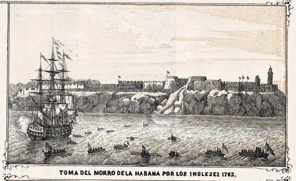 Image 3A: British invasion of Havana in 1762
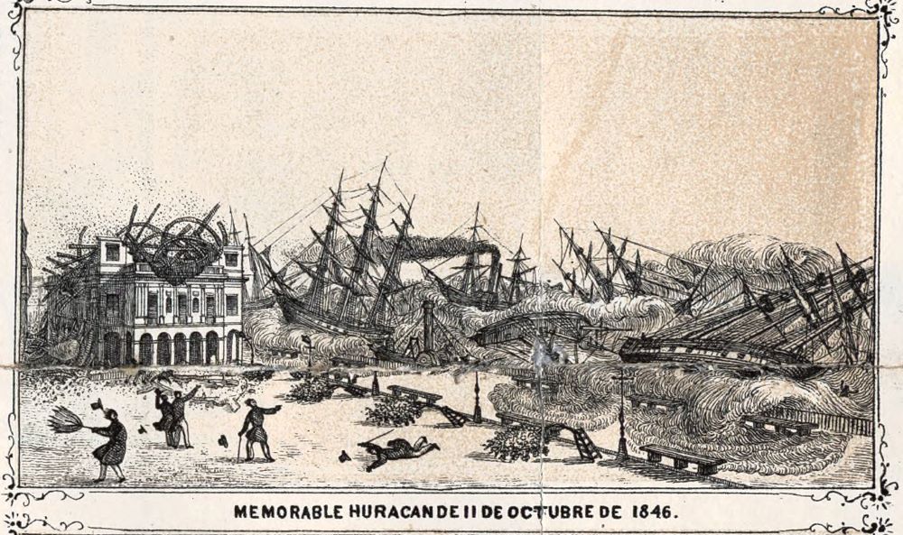 Image 3B: The aftermath of the Hurricane of 1846
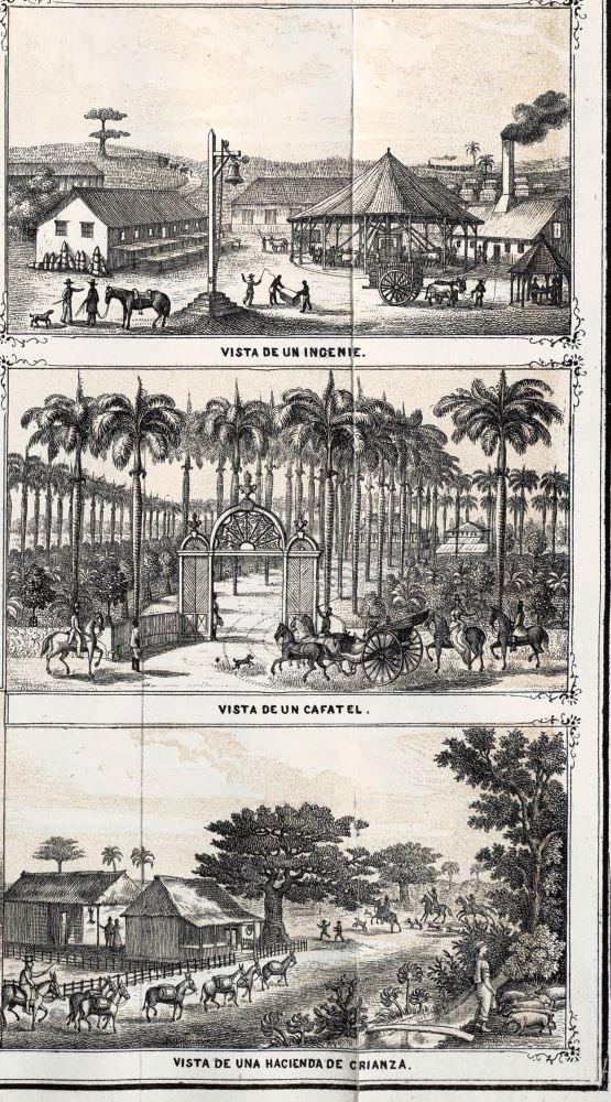 Image 3C: Virtually slave-free depictions of slavery
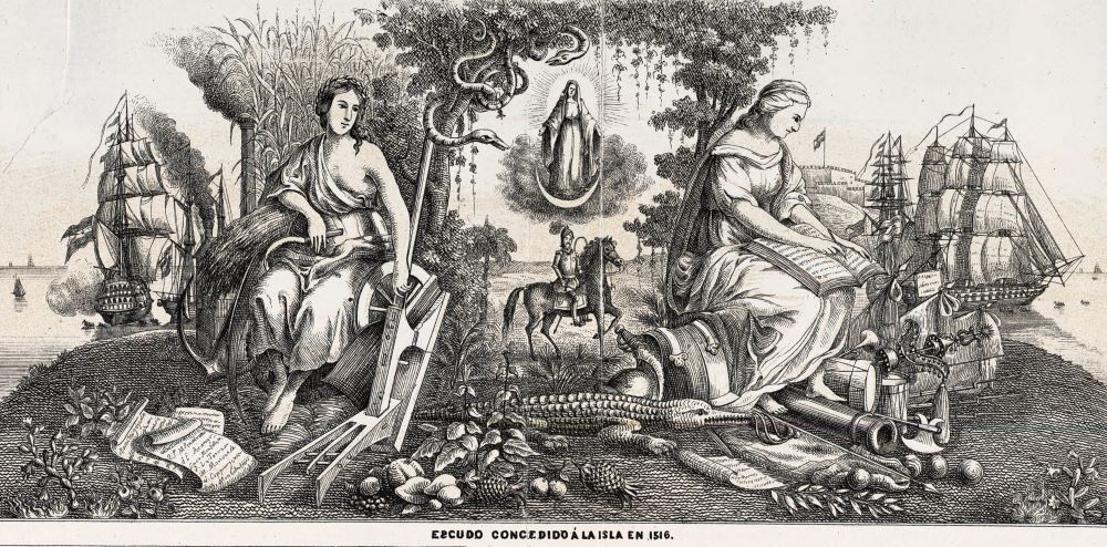 Image 3D: Icon of the Virgin Mary
Special thanks for this curation to Dean of Libraries Judith Russell and Librarians Carol McAuliffe, Adrienne Johnson, Paul Kirk and Jennifer Farrington.
